Last weekend we went to Lithuania. The plan was to see the town of Zarasai, the surroundings, and the Stelmužė Oak located nearby. Other sights were a bit too far away, or their coordinates were impossible to find. Even in our age of GPS dominance, coordinates are still forever missing on websites. The state-run ones are understandable, they're always lagging behind progress, but why private campsites and museums don't put them up is a mystery.
The expedition crew: me, punk, and Olya https://voljushka.livejournal.com/, who is supposedly going to make a video. On the first day we also had silent Sergey with us, about whom I know absolutely nothing.
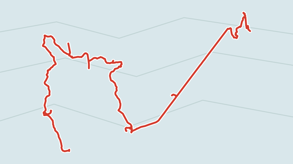
Day one track, 108 km.
Plan your trips with EveryTrail Mobile Travel Guides
According to the bike computer we rode more, but it counts taking climbs and descents into account, not just on a flat plane.
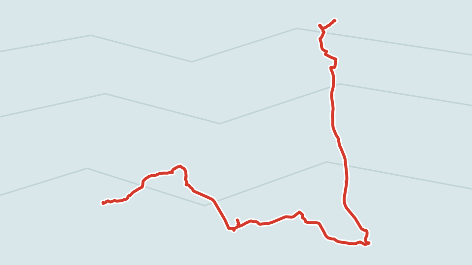
Day two track:
Plan your trips with EveryTrail iPhone Travel Guides
Next up are photos and some impressions.

Olya is filmin' the rusted Zarasai.

Actually, Zarasai is a cool town. As punk says, "I'd live here." Pay attention (Lebedev-style, speak of the devil) to the town's brand logo on the poles.
In the center of Zarasai there is a lake with a peninsula (you can consider it an island too), and there are thousands of them around in general, so the focus on such a symbol makes sense.

In the town center it's extremely clean and tidy everywhere.


Near the local Maxima, a kebab was conveniently being sold. The saleswoman scared me that the spicy sauce was very spicy. A young Lithuanian woman with a kid who walked up and I lazily agreed that it probably wasn't spicy at all. And so it turned out, quite medium spiciness. Even more conveniently, a vegetarian kebab was sold too, so punk was able to eat one on the way back as well.

Here's what my bike looks like fully geared up. Well, without the tent — punk carried that.

The town beach is located on the aforementioned island.

And spots for concerts too.

This is the incredible road to the Stelmužė Oak. Incredibly winding and bending, both up and sideways. In general, it must be said that Lithuanians have asphalt everywhere, just some wild amount of asphalt. It makes you incredibly happy — riding is easy and pleasant, you can see a lot, make it everywhere in time. The asphalt, by the way, is usually very good, only so-so in places.

And here is the Stelmužė Oak itself. The Lithuanians advertise it as the oldest in Europe, over 2000 years old. A Soviet? pole next to the oak acts a bit more modest — it says a thousand and a half.


The oak is on props. After such wild heat that we rode through (over 30), we could have used some props too.

There is a museum near the oak, but it was closed due to the building's emergency condition. This I translated from Lithuanian. When we have signs in English everywhere, or in Esperanto, that's when we can say it's Europe. But until then — it's the provinces, albeit cute ones.

Not far from the oak there is a pretty massive stone.
https://www.zarasai.lt/tic/ru/index.php?kas=230
Stelmužė village, Zarasai district
In the Ligumai forest (1.6 km from the Stelmužė Oak) the second 'Puntukas' looms. The stone is also called the Devil's Stone. They say that 30 hunters could fit on it, who used to gather in the old days to discuss their manly affairs. The length of the stone is 8 m, height - 2 m, width - 3.5 m
After the oak and the stone, we pedaled for a long, long time (it felt like), but just couldn't find the lake, or rather an approach to it. Despite the number of lakes around Zarasai, getting to them is far from always possible. Either it's private property, or it's all overgrown with cattails.
But when we did find one, we experienced simply pure happiness.


Lithuanians love to show off on their private estates even more than our folks do.


It's getting dark, and still no campsite.

Curiously, in Lithuania they write the names of all decently sized lakes on signs. However, oddly enough, they never write the names on rural bus stops anywhere. Back home, almost all bus stops have a name.

Punk and I are adventurers, and we just ride in a general direction, partly at random. To Olya this approach still seems a bit wild, so we consulted the GPS and map quite a bit. Unfortunately, my iPhone GPS requires internet, and roaming is expensive. Olya prudently printed out a map, but one time I didn't pay attention to the fact that there's a road on the map but not on the GPS, and we almost ended up spending the night on a public beach in the spot you see in the next photo. Fortunately, we didn't have to.


Olya looks like a bandit in her signature bandana that has been through hell and high water with her. Olya actually has a rich biography: she is getting her third higher education degree, has been a teacher, a choreographer, and an engineer, played the piano and the flute, and I won't mention the rest, so as not to completely violate her privacy.

We even tried calling the campsite, but it didn't work out. We went at random. I generally think that it's not hard to ride around a small lake to find a campsite or a place for a tent, but the folks were already tired. As luck would have it, Olya's bike bags didn't arrive on time and she lugged a backpack around, which is uncomfortable. And I didn't take her tent at the beginning of the expedition, which was a mistake. I'm training like a beast anyway, so I can ride far and high, the extra load is good for me.


Happiness has arrived. We found some sign obviously meaning that this is a place for a tent. With a phone number. We didn't call, though. I simply asked a local vacationer if we could pitch a tent. He apparently had nothing to do with the sign, but generously allowed it, which calmed my conscience. If the campsite owners find this post and demand their dough, I'm ready to transfer it, because we did burn a certain amount of firewood while we spent the night, I confess.


Otherwise we behaved decently, clean
ed up our trash, left no traces.


Our tents are super basic, but without rain and wind it doesn't matter anyway.

We had breakfast with an unusually sweet pomelo and apples.


The bicycles on the alarm at night (I hope bandits won't read this post).

This is half a day later, when we made it almost to the border, in Turmantas. Its only attraction is that the railway from Latvia passes through here. I confess, I broke down, ate two ice creams in two days and drank a ton of lemonade. I still lost weight, though — that's how brisk our pace was.
By the way, they accepted cards even in the most remote village shops, so there's not really much need to exchange money, except maybe for the campsite and kebab.

This is Lake Drūkšiai. I didn't realize it right away, this huge body of water stretches into the territory of the Republic of Belarus, where it's called Drysviaty, also known as Lake Braslav, and we saw it on our bike trip during last Ligo. The Belarusians consider the lake theirs, but the Lithuanians' part is almost three times larger, as Wikipedia tells us.
Drysviaty (Drūkšiai, Lit. Drūkšiai, Belor. Drysviaty) — a lake on the border of Zarasai District of Lithuania and Braslaw District of Vitebsk Region of Belarus, 2 km south of Latvia, on the northeastern edge of the Baltic Uplands. One of the most significant of the Braslaw group of lakes. The largest lake on the territory of Lithuania. Until the closure of the Ignalina NPP, it was the water source for the station.
[edit] Description
The area of the lake is 44.79 km² (about 34 km² belongs to Lithuania, approx. 10 km² to Belarus). During the movement of glaciers, two perpendicular elongated depressions were formed, stretching from north to south and from west to east. The maximum depth of the first depression is 29 m, the second — 33.3 m. The greatest depths are located in the center of the lake. The shallowest is the southern tip of the lake, where depths do not exceed 3-7 m. Water transparency reaches 4 m. The shores are mostly sandy.
The lake near the village of Tilzi, where we swam, is shallow, not even interesting. In general, we swam along the way at the slightest opportunity. It's harder for girls here — changing clothes isn't so simple.
After Lake Drūkšiai we crossed the border on a terrible dirt road. The border post stands, but there are no people in it. On the main road, though, where we entered, they even demolished the post. In Demene we swam in Lake Briģene. The only one, by the way, where the water was cool — in all the others along the way it was so warm it didn't even cool you down. We didn't swim in Lake Dervanišku, decided to just ride straight home, despite the heat. Funny enough, as soon as we arrived, a terrible downpour started, and continued, turning into a drizzle, until the evening and beyond. Talk about getting lucky.
Overall, we seemed to like everything. Maybe next time I'll still call the campsite in advance, so as not to scare the more prudent participants.
We'll undoubtedly go to Lithuania again, since the roads are excellent, and there's a lot more to see. The problem, however, is that two days is not enough. I had an interesting idea here: we could rent a minivan there on a Friday evening, and ride back on our own.